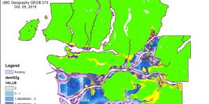
Intro to GIS: Planning for flooding/Storm Surge
In this assignment, I worked more closely with spatial and tabular datasets, both raster and vector, and was also exposed to a variety of basic GIS Analysis tools, to produce a series of maps that highlight the areas in Metro Vancouver that are at risk to flooding during a storm surge.