Intro to GIS: Personal Statement
Personal Statement - reflection as a result of learning with GIS Science
GEOB270
Personal Statement - reflection as a result of learning with GIS Science
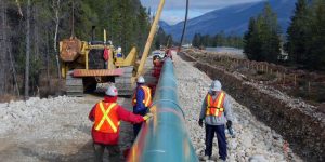
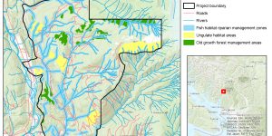
Our final group project focused on the potential leak impacts on both built infrastructure and natural environment from the Trans Mountain Pipeline Extension Project.
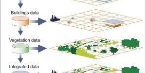
In this assignment, I produced two maps of ecologically sensitive areas (one showing the project area and snow line/high elevation and protected areas and the other showing the same data draped on a 3D Hillshade) from the Proposed Garibaldi at Squamish Ski Hill Project in British Columbia, Canada. I incorporated all the Ben Fry's stages of an effective data visualization to determine areas that must be ecologically protected and undisturbed from the development of the Ski Hill project.
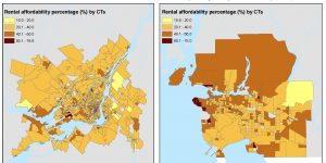
In this assignment, I joined variables in tabular files to spatial maps files for Census Tracts (CTs) in both Metro Vancouver and Montréal. I then visualized and worked with rental housing cost data by exploring various methods for classifying quantitative data (monthly cost of rent) for Metro Vancouver CTs, comparing the monthly costs to Montréal, and also looked at another rental indicator which is housing affordability (the percent of people spending more than 30% of their income on rent).
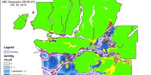
In this assignment, I worked more closely with spatial and tabular datasets, both raster and vector, and was also exposed to a variety of basic GIS Analysis tools, to produce a series of maps that highlight the areas in Metro Vancouver that are at risk to flooding during a storm surge.