In this assignment, I worked more closely with spatial and tabular datasets, both raster and vector, and was also exposed to a variety of basic GIS Analysis tools, to produce a series of maps that highlight the areas in Metro Vancouver that are at risk to flooding during a storm surge.
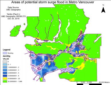
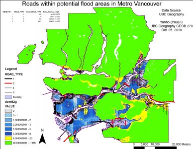
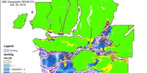
Familiarized a variety of GIS analysis tools including ‘Buffer’, ‘Reclassify’, ‘Intersect’ and ‘Select by Location’ and assembled these tools to create maps of potential storm surge flood areas (at or below 5 kilometers elevation and extend to 1 km inland from the shoreline) and infrastructure (roads) that fall within the flooding risk areas
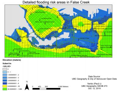
A major weakness or limitation as observed in the ArcMap analysis is a cluster of points (e.g. school symbols) on a map as it becomes harder for readers to identify and understand the pattern – overlapping of points makes the map harder to read. In terms of the DEM resolution, it could significantly affect the potential flooding areas in Metro Vancouver as discussed in question 16 where larger flooding risk areas are covered under 1m resolution compared with 25m. A higher resolution such as 1m could improve the accuracy of the exact shape, boundaries or shorelines of an area by improving the quality of pixels which reflect more accurate values, thus improving the accuracy of detailed colors of different values. Hence, DEM resolution is directly related to each pixel color by assigning specific reflectance values (which correspond to specific colors) – the more divided the pixels (usually within a pixel), the higher the resolution – under 1m resolution the length of one pixel 1 meter contains more details than 25m. When the resolution is unchecked and a layer with different resolution is incorporated into another, the exact area covered by one variable (e.g. flooding risk) is undermined or affected – hence the highest possible resolution should always be adopted in the first place and must remain uniform and consistent throughout the layer folder and with each individual layer. When computing the raw data csv files into shape files in ArcMap, it is usually essential to check for the x, y coordinates (hence longitudes and latitudes of different points) to check for the completeness of these numbers as there should be no cut-off of values/numbers.